
Blog · marine protected areas
A reserve made of islands: the Guano Islands, Islets and Capes System
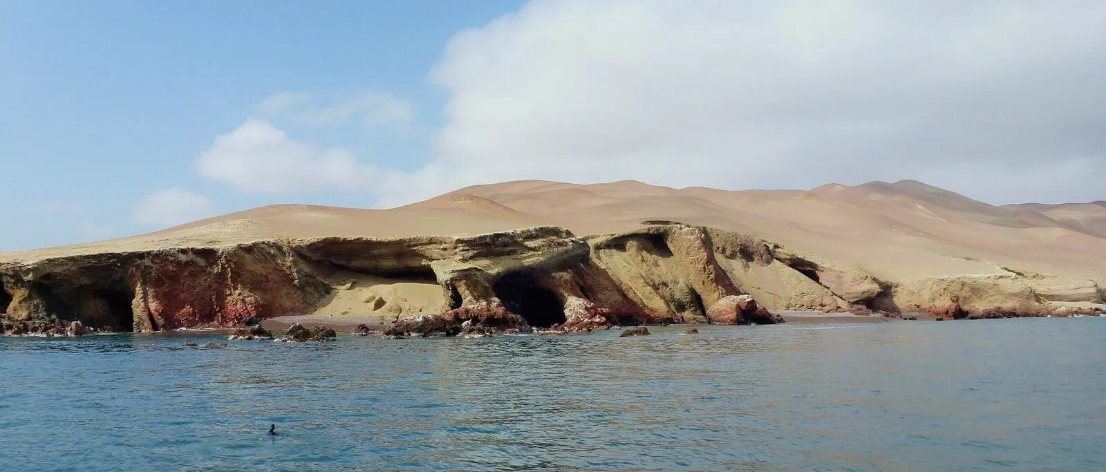
The reserve brings together 22 islands and 11 capes along about 1,700 km of the Peruvian coast. It protects the colonies of guano birds, the Humboldt penguin and the sea lions that depend on the upwelling of the Humboldt Current.
Published

What it protects and why
The Guano Islands, Islets and Capes System National Reserve was established by Supreme Decree 024-2009-MINAM on 31 December 2009.1 It was created to conserve a sample of the biodiversity of the coastal and marine ecosystems of the cold sea of the Humboldt Current and to maintain the life cycle of the species that inhabit them.1 One of its objectives is to shelter the seabirds and marine mammals that take refuge in those places or pass through them on migration.1
The current plan shortens the name to RNIPG, whereas the 2016 plan shortened it to RNSIIPG.12 The total area is 140,833.47 hectares, 97.5 % of it marine environments.1 The official list of protected areas and the resolution approving the plan give the same area figure.34 The 2016 plan explains that the reserve protects, besides the island or mainland space, the sea out to about two miles around it, and defines it as a biological corridor for seabirds and marine mammals native to the Humboldt Current.2
Upwelling in the Humboldt Current brings nutrients from the depths to the surface, which keeps primary production very high.1 That productivity favours an abundance of forage fish and supports small-scale fishing.1 In that setting the islands and capes give guano birds, Humboldt penguins, sea lions, marine otters and benthic organisms places to breed, rest, feed and shelter.1
From north to south: islands, islets and capes
The current plan describes the reserve as 22 islands and 11 guano capes facing eight departments, spread along about 1,700 km of the Peruvian coast.1 It covers almost the whole length of the coast, from 6° to 17° south latitude.1
The 22 islands and islets, from Isla Lobos de Tierra in the north to Isla Ballestas in the south, add up to 2,847.33 hectares of land spread over 15 polygons.5 The 11 capes run from Punta Culebras (Áncash) to Punta Coles (Moquegua) and cover 671.175 hectares of land.67 The two land figures together are a small fraction of the 140,833.47 hectares, which agrees with the 97.5 % of marine area.571
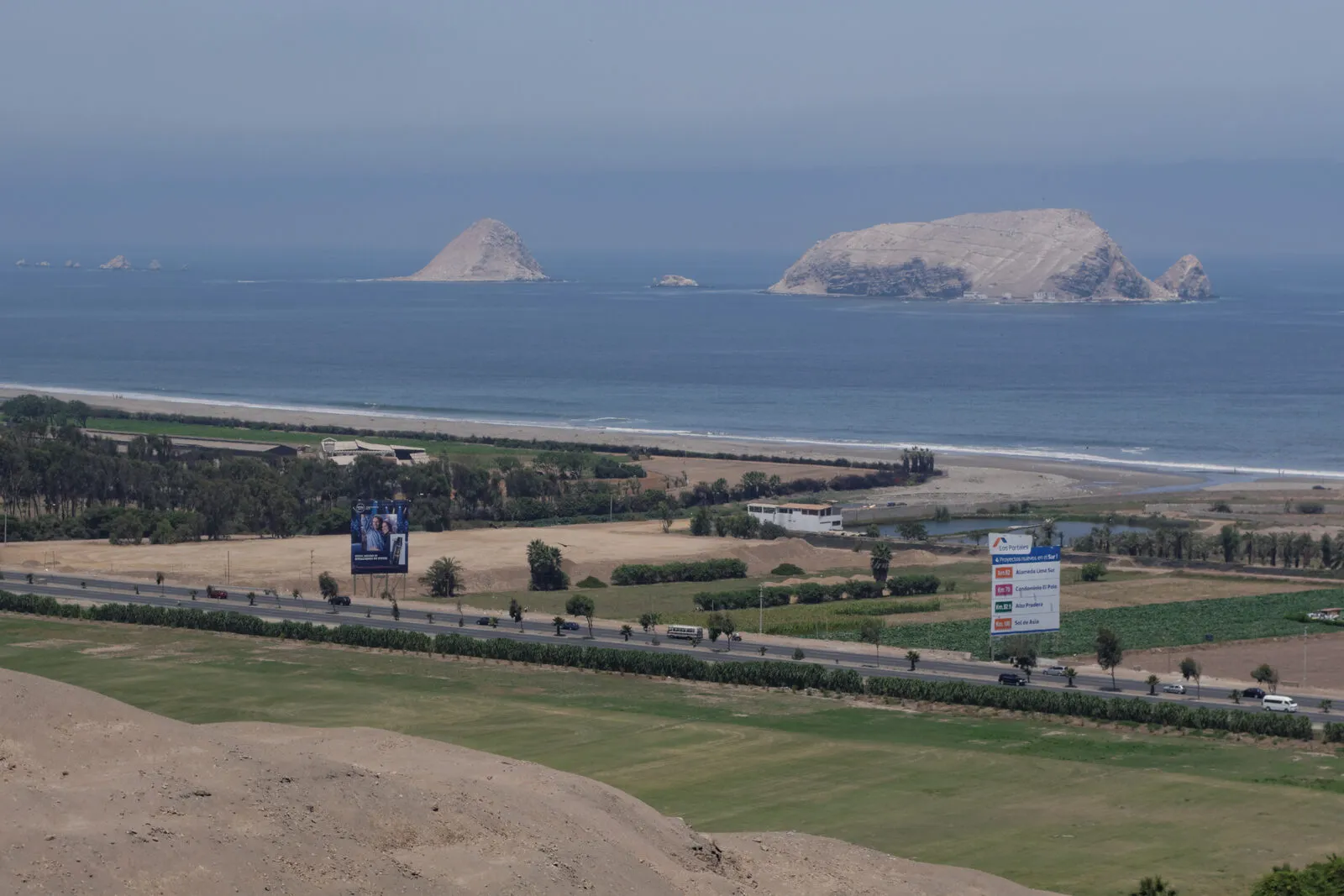

Among the islands are Lobos de Tierra, Lobos de Afuera, Macabí, Guañape Norte and Guañape Sur, Chao, Santa, Don Martín, Huampanú, Mazorca, Asia, the Chincha islands and the Ballestas islands.3 Among the capes are Culebras, Colorado, La Litera, Salinas, Lomitas, San Juan, Lomas, Atico, La Chira, Hornillos and Coles.7
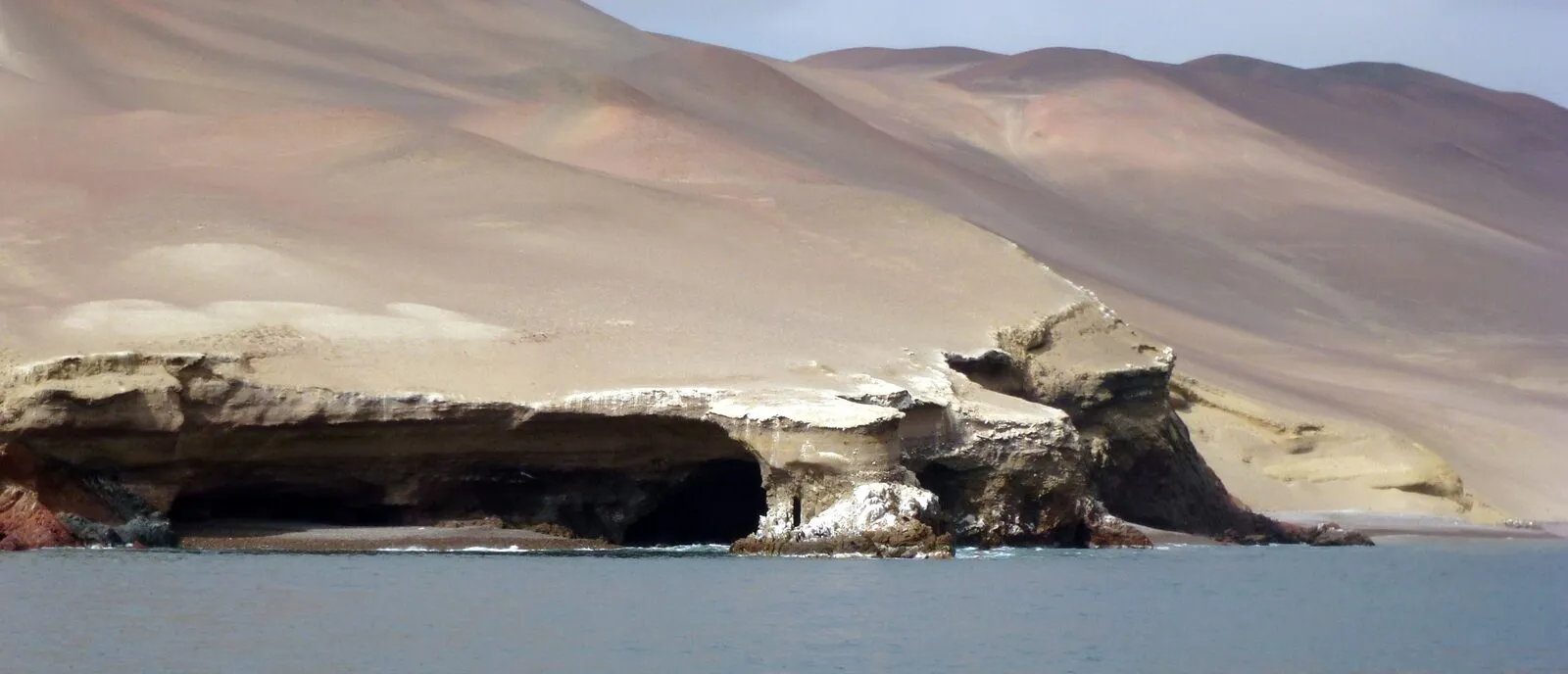

How many units the reserve has depends on how they are grouped.3 The official list numbers its units from RN13.01 to RN13.33, which is 33 codes, and presents them in 25 rows.3 Both plans speak of 25 polygons or sectors, and the 2016 plan sums them up as 22 islands and 11 capes divided into 25 polygons.89
According to the Marine Ecoregions of the World classification, the reserve lies in the Central Peru ecoregion, from the Illescas peninsula (6° south latitude) to San Lorenzo island (12° south latitude), and in the Humboldtian ecoregion, from 12° to 25° south latitude.10
Guano birds, penguin and marine mammals
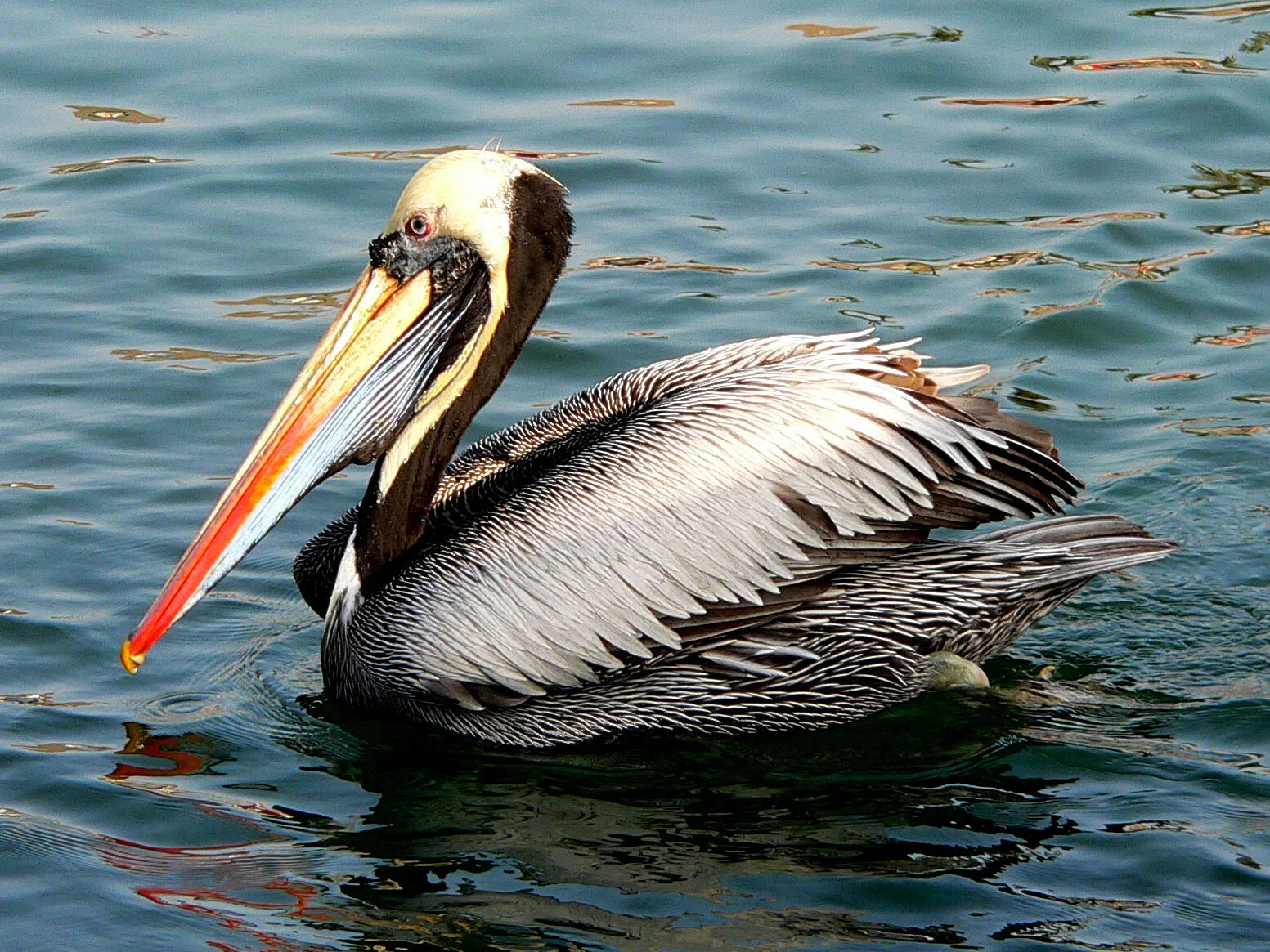
The plan names three guano birds: the guanay cormorant (Leucocarbo bougainvillii), the Peruvian booby (Sula variegata) and the Peruvian pelican (Pelecanus thagus).11 They depend on the anchoveta (Engraulis ringens), which in the Peruvian booby is up to 98 % of its intake.11 The guanay and the booby breed between November and January, and the pelican between September and March.11
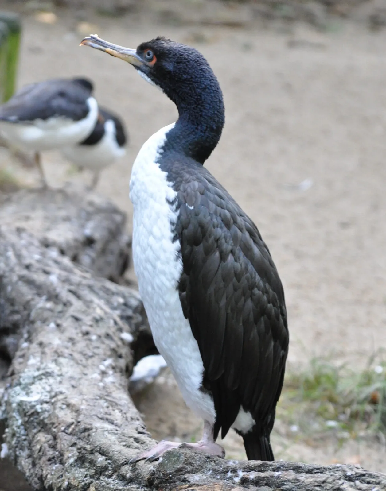

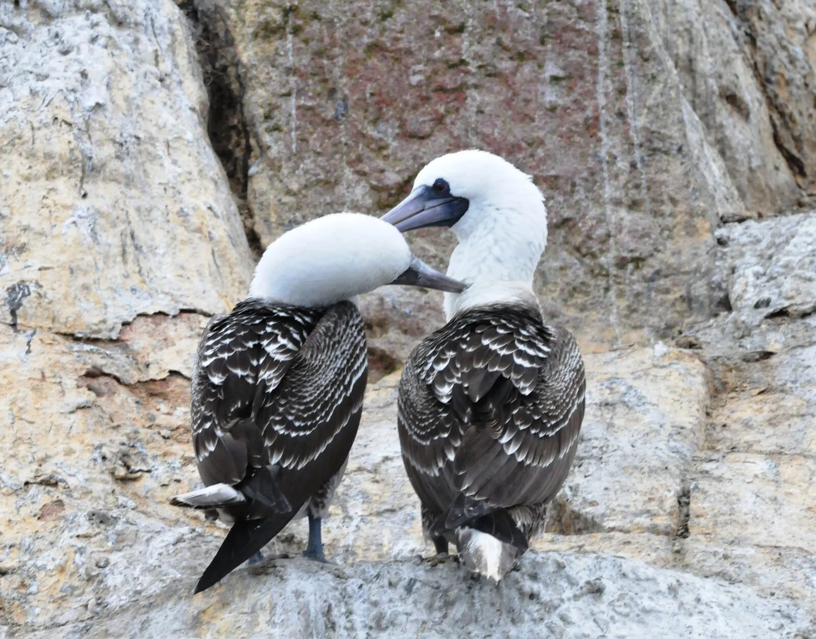

Between 2022 and 2025 these birds went through the most critical period recorded in the reserve, marked by H5N1 avian influenza and by El Niño 2023-2024.12 The guanay fell from 2,328,610 to 328,650 individuals, the Peruvian booby from 1,317,446 to 185,478 and the Peruvian pelican from 87,344 to 34,455.12 For 2025 the annual population of guano birds was estimated at 548,583 individuals.12

Two figures in the plan do not match each other.1312 The plan's general section adds up 163,814 dead birds between November 2022 and May 2025, and the species section gives 163,813.1312 For the population before the outbreak, that general section speaks of between 3 and 4 million birds and the ecosystem services section of more than 4 million.1314
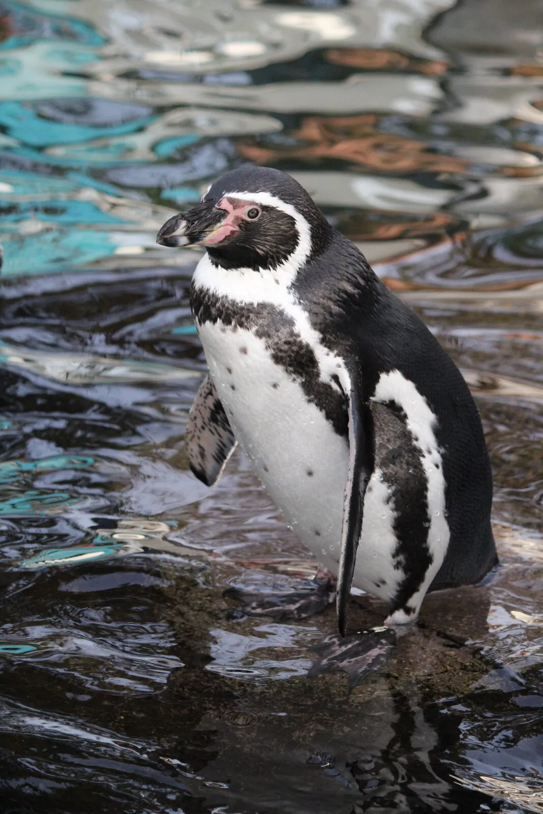
The Humboldt penguin (Spheniscus humboldti) went from 13,298 individuals in 2016 to 8,580 in 2017, 8,384 in 2022 and 3,082 in 2023; in 2025, 4,839 were recorded.15 Its main colonies are at Punta San Juan, Isla Ballestas, Islas Guañape Norte, Isla Macabí, Isla Huampanú and Punta Coles, where it uses caves and fissures in rocky environments.15

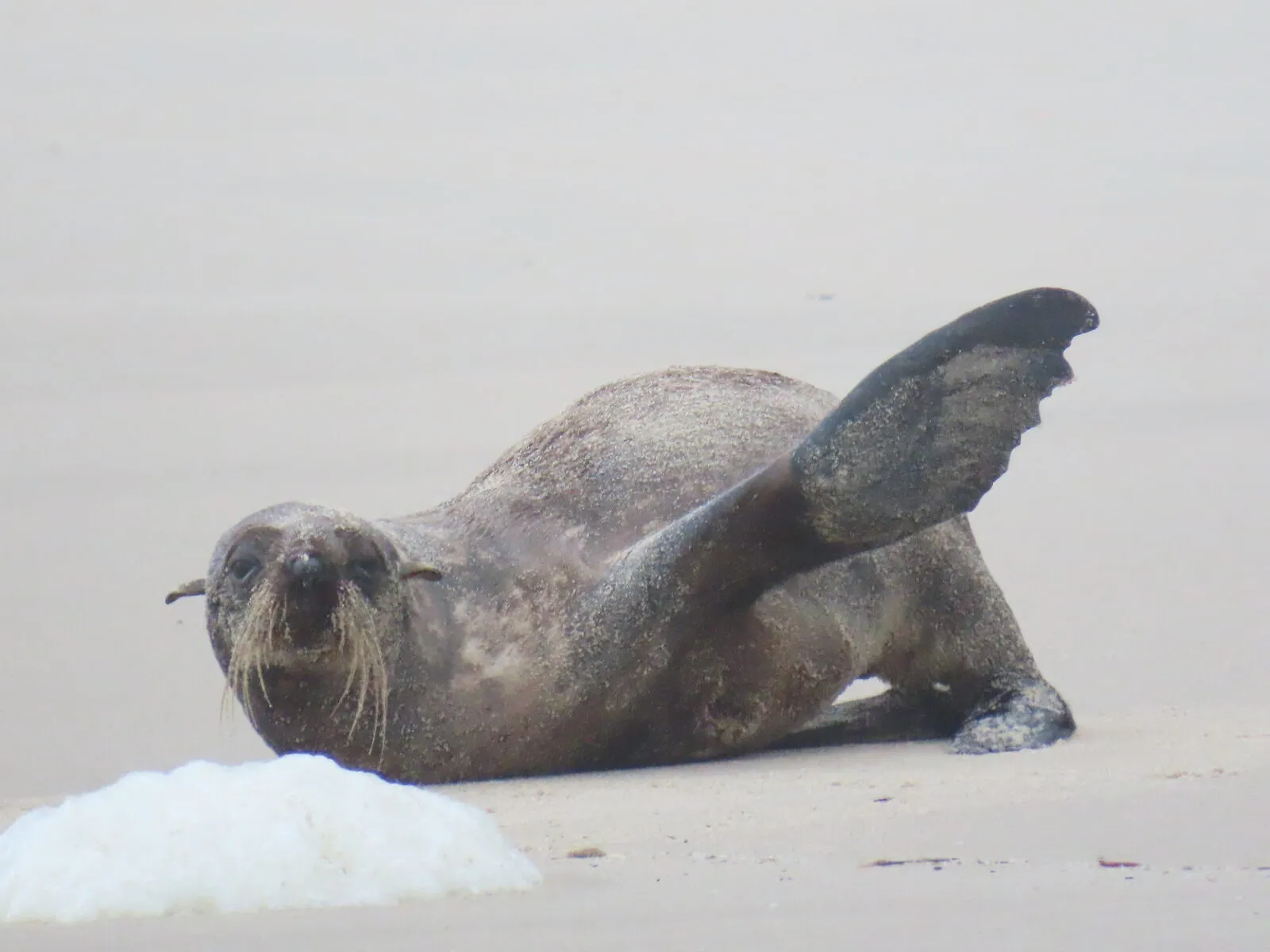
The priority coastal marine mammals are the South American sea lion (Otaria flavescens), the South American fur seal (Arctocephalus australis) and the marine otter (Lontra felina).16 The sea lion is the most abundant, with 29,739 individuals in 2021, 10,506 in 2024 and 14,437 in 2025.17 The fur seal has a more restricted distribution, with colonies at Punta San Juan, Isla Chincha, Punta Atico and Punta Coles, and went from 6,464 individuals in 2017 to 2,772 in 2025.18 The marine otter is the only marine mustelid of the Peruvian coast and the plan records it in twelve sectors, from Isla Chao to Punta Coles.18

The 2016 plan listed, citing Supreme Decree 004-2014-MINAGRI, the guanay as Near Threatened; the Peruvian booby, the Peruvian pelican, the Humboldt penguin and the fur seal as Endangered; and the sea lion as Vulnerable.19 It added that these spaces are the last places in the country where these species are protected.19
Guano: what the plan says
The 2016 plan recalls that, because of scarce rainfall, the droppings of birds and mammals known as island guano accumulate.20 According to that plan, which cites Buse (1973) and Stucchi and Figueroa (2006), the resource has been used as a fertiliser since the Mochica and the Peruvian State has exploited it intensively since 1842.20 It adds that this exploitation removed the habitat of several birds, such as the Humboldt penguin, the Peruvian diving-petrel and the storm petrel, and that zoning provides for the gradual recovery of their breeding sites.20
The same plan says the activity peaked in the 19th century and that, when it was written, the volumes extracted had fallen markedly.21 It also sets out that collection must not affect the breeding of the birds or mammals that live on the islands and capes.21
The current plan describes island guano as an organic fertiliser rich in nitrogen, phosphorus and potassium, which has supported national agriculture for more than a century and is managed under an annual management plan.22 Between 2016 and 2025, 216,155 tonnes were collected, reaching more than 118 thousand small farmers.14 In 2025 it was 19,503 tonnes, distributed to about 32,180 farmers for 64,360 hectares of crops.14
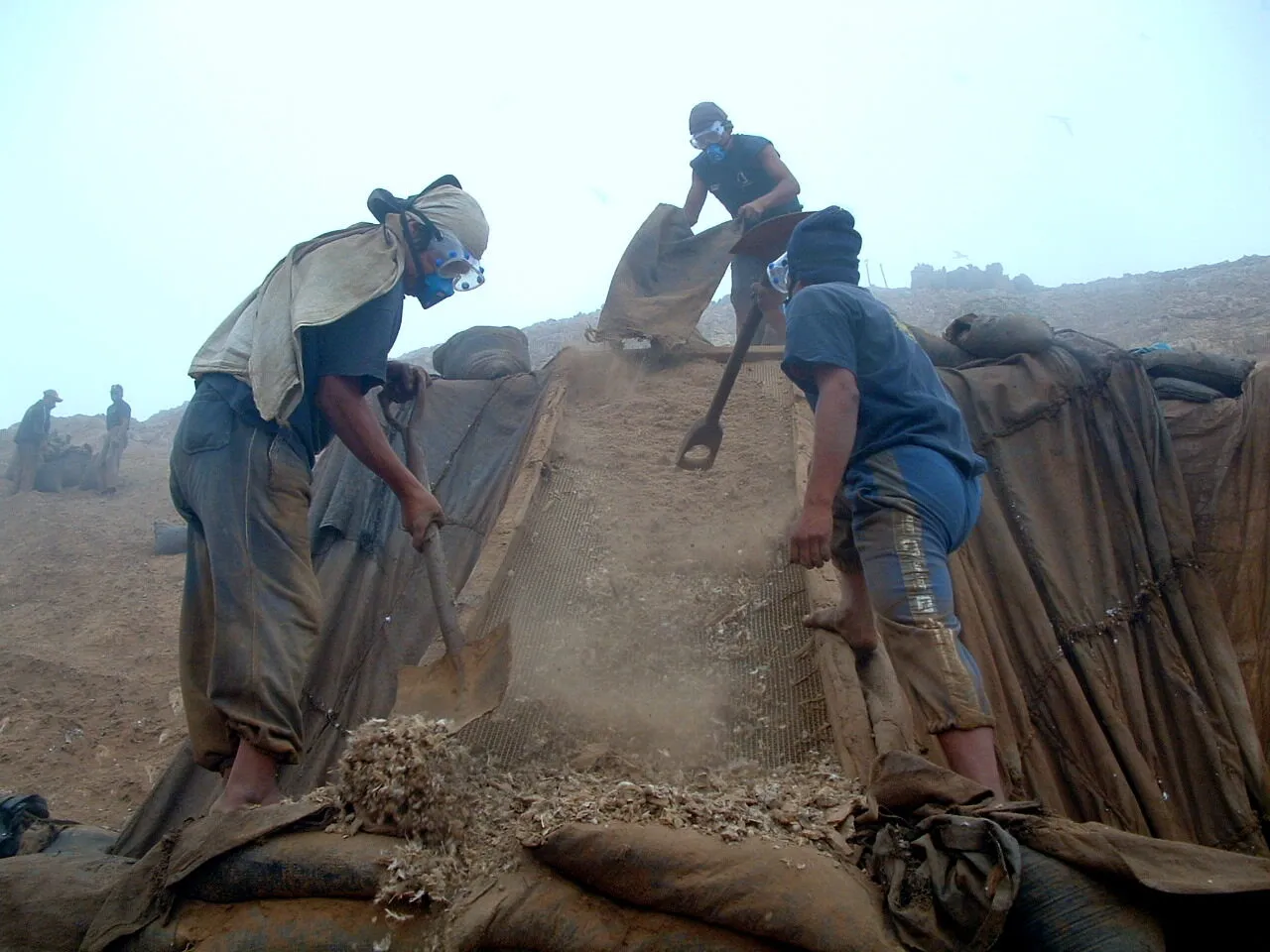

In the direct-use zone of the Ballestas Islands, guano use is permitted only to the competent entity, under an annual management plan approved by SERNANP.23 It is authorised only when the guano birds are not breeding, and it is prohibited in the Humboldt penguin's resting, nesting and moulting areas.23
The plan warns that guano supply depends on the recovery of the guano bird populations.14 If the colonies do not reach the levels they had before the epizootic, the service could collapse.14
Threats
The plan identifies nine direct threats: illegal and unregulated fishing, inadequate disposal of solid waste and effluents, oil spills, informal tourism, bycatch, illegal guano extraction, the introduction of exotic species (rats, cats and dogs), illegal hunting of wildlife and poor non-metallic mining practices.24
Its threats-by-sector table marks illegal fishing and poor waste disposal in all 25 sectors, bycatch in 21, informal tourism in 15, exotic species in 13, illegal guano extraction in 12 and oil spills in 7.25 Illegal hunting appears in 3 sectors and poor non-metallic mining practices in one, Punta San Juan.2526
Of informal tourism the plan describes unauthorised landings, excessive approaches to colonies of birds and marine mammals and failure to keep safe distances in breeding or resting areas.2728 Engines, voices and erratic boat movements can alter resting and breeding patterns and lead to the abandonment of critical areas.28
Bycatch rises at night, because lights and floodlights on small-scale boats draw birds to the fishing gear.28 Illegal guano extraction disturbs the stability of the guano substrate, which is essential for bird breeding.28 Rats, cats and dogs prey on eggs and chicks.26 The plan also cites microplastics in 68 % of the pellets analysed.29
Besides human threats, the plan records climatic events and emerging zoonotic diseases that have affected protected species.24 It says they cannot be controlled directly, but they can be monitored to prevent, adapt and respond in time.24
How it is managed
Management has five administrative offices: the north office in Huanchaco (La Libertad), the centre office in La Punta (Callao), the mid-south office in Paracas (Ica), the south office in Ilo (Moquegua) and the head office in Lima.10 The current zoning includes a strict protection zone, a wild zone, a recovery zone and a direct use zone.10
Of the 15 island polygons, 11 have specific zoning, and the strict protection zone exists only on Isla Pachacamac.5 The other four (Islas Cavinzas and Islotes Palominos, Islote Corcovado, Isla Chao and Islas Macabí) are direct use zones.5 Among the capes, three (Coles, San Juan and Salinas) have specific zoning, and the other eight are entirely direct use zone, which the plan takes as a sign that more detailed zoning is needed.7
The surveillance and control strategy provides for sea and land patrols and remote surveillance with drones, positioning systems and vessel tracking.8 Another strategy is an emergency, conservation and restocking action plan to respond to health emergencies, oceanographic phenomena and pollution events.30
Tourism is regulated through site plans that set carrying capacity, schedules, permitted routes, minimum observation distance and safety protocols.13 Those plans restrict visitor landings on Isla Ballestas, on the Islas Cavinzas and Islotes Palominos and on the Islas Guañape.5 In the Ventana sector of Isla Ballestas Centro, tourist boats must keep the distances set by the site plan, and extracting resources or altering habitats is prohibited.23
On governance, between 2019 and 2024, 24 conservation agreements were consolidated with the participation of 796 people.31
What changed from the earlier plan
Executive Presidency Resolution 000102-2026-SERNANP/PE, of 13 May 2026, approved the 2026-2031 Master Plan.4 According to its text, the earlier plan had been approved by Presidential Resolution 048-2016-SERNANP.4
The 2016 plan presented itself as the reserve's first master plan, with a management committee of more than 1,100 stakeholders from nine departments.9 It spoke of four administrative offices; the current plan speaks of five.910
The two plans agree on 22 islands, 11 capes and 25 polygons.918 On zoning, the 2016 plan identified three types of zone (wild, direct use and recovery) over the 25 polygons.32 The current plan adds the strict protection zone, which among the islands it uses only on Isla Pachacamac.105
Species mentioned
- Phalacrocorax bougainvillii
- Sula variegata
- Pelecanus thagus
- Spheniscus humboldti
- Otaria byronia
- Arctocephalus australis
- Engraulis ringens
Sources (32)
- SERNANP (2026). Plan Maestro de la Reserva Nacional Sistema de Islas, Islotes y Puntas Guaneras 2026-2031 (plan vigente), p. 11 del PDF. sis.sernanp.gob.pe
- SERNANP (2016). Plan Maestro de la Reserva Nacional Sistema de Islas, Islotes y Puntas Guaneras 2016-2020 (plan anterior, superado por el de 2026-2031), p. 12 del PDF. sinia.minam.gob.pe
- SERNANP (2026). Listado oficial de áreas naturales protegidas, 9 de setiembre de 2026, p. 1 del PDF. cdn.www.gob.pe
- SERNANP (2026). Resolución de Presidencia Ejecutiva N.° 000102-2026-SERNANP/PE, 13 de mayo de 2026, pp. 1 a 3 del PDF. cdn.www.gob.pe
- SERNANP (2026). Plan Maestro de la Reserva Nacional Sistema de Islas, Islotes y Puntas Guaneras 2026-2031 (plan vigente), p. 30 del PDF. sis.sernanp.gob.pe
- SERNANP (2026). Plan Maestro de la Reserva Nacional Sistema de Islas, Islotes y Puntas Guaneras 2026-2031 (plan vigente), p. 28 del PDF. sis.sernanp.gob.pe
- SERNANP (2026). Plan Maestro de la Reserva Nacional Sistema de Islas, Islotes y Puntas Guaneras 2026-2031 (plan vigente), p. 29 del PDF. sis.sernanp.gob.pe
- SERNANP (2026). Plan Maestro de la Reserva Nacional Sistema de Islas, Islotes y Puntas Guaneras 2026-2031 (plan vigente), p. 63 del PDF. sis.sernanp.gob.pe
- SERNANP (2016). Plan Maestro de la Reserva Nacional Sistema de Islas, Islotes y Puntas Guaneras 2016-2020 (plan anterior, superado por el de 2026-2031), p. 11 del PDF. sinia.minam.gob.pe
- SERNANP (2026). Plan Maestro de la Reserva Nacional Sistema de Islas, Islotes y Puntas Guaneras 2026-2031 (plan vigente), p. 13 del PDF. sis.sernanp.gob.pe
- SERNANP (2026). Plan Maestro de la Reserva Nacional Sistema de Islas, Islotes y Puntas Guaneras 2026-2031 (plan vigente), p. 34 del PDF. sis.sernanp.gob.pe
- SERNANP (2026). Plan Maestro de la Reserva Nacional Sistema de Islas, Islotes y Puntas Guaneras 2026-2031 (plan vigente), p. 35 del PDF. sis.sernanp.gob.pe
- SERNANP (2026). Plan Maestro de la Reserva Nacional Sistema de Islas, Islotes y Puntas Guaneras 2026-2031 (plan vigente), p. 14 del PDF. sis.sernanp.gob.pe
- SERNANP (2026). Plan Maestro de la Reserva Nacional Sistema de Islas, Islotes y Puntas Guaneras 2026-2031 (plan vigente), p. 45 del PDF. sis.sernanp.gob.pe
- SERNANP (2026). Plan Maestro de la Reserva Nacional Sistema de Islas, Islotes y Puntas Guaneras 2026-2031 (plan vigente), p. 37 del PDF. sis.sernanp.gob.pe
- SERNANP (2026). Plan Maestro de la Reserva Nacional Sistema de Islas, Islotes y Puntas Guaneras 2026-2031 (plan vigente), p. 38 del PDF. sis.sernanp.gob.pe
- SERNANP (2026). Plan Maestro de la Reserva Nacional Sistema de Islas, Islotes y Puntas Guaneras 2026-2031 (plan vigente), p. 39 del PDF. sis.sernanp.gob.pe
- SERNANP (2026). Plan Maestro de la Reserva Nacional Sistema de Islas, Islotes y Puntas Guaneras 2026-2031 (plan vigente), p. 40 del PDF. sis.sernanp.gob.pe
- SERNANP (2016). Plan Maestro de la Reserva Nacional Sistema de Islas, Islotes y Puntas Guaneras 2016-2020 (plan anterior, superado por el de 2026-2031), p. 18 del PDF. sinia.minam.gob.pe
- SERNANP (2016). Plan Maestro de la Reserva Nacional Sistema de Islas, Islotes y Puntas Guaneras 2016-2020 (plan anterior, superado por el de 2026-2031), p. 18 del PDF. sinia.minam.gob.pe
- SERNANP (2016). Plan Maestro de la Reserva Nacional Sistema de Islas, Islotes y Puntas Guaneras 2016-2020 (plan anterior, superado por el de 2026-2031), p. 27 del PDF. sinia.minam.gob.pe
- SERNANP (2026). Plan Maestro de la Reserva Nacional Sistema de Islas, Islotes y Puntas Guaneras 2026-2031 (plan vigente), p. 44 del PDF. sis.sernanp.gob.pe
- SERNANP (2026). Plan Maestro de la Reserva Nacional Sistema de Islas, Islotes y Puntas Guaneras 2026-2031 (plan vigente), p. 170 del PDF. sis.sernanp.gob.pe
- SERNANP (2026). Plan Maestro de la Reserva Nacional Sistema de Islas, Islotes y Puntas Guaneras 2026-2031 (plan vigente), p. 54 del PDF. sis.sernanp.gob.pe
- SERNANP (2026). Plan Maestro de la Reserva Nacional Sistema de Islas, Islotes y Puntas Guaneras 2026-2031 (plan vigente), p. 59 del PDF. sis.sernanp.gob.pe
- SERNANP (2026). Plan Maestro de la Reserva Nacional Sistema de Islas, Islotes y Puntas Guaneras 2026-2031 (plan vigente), p. 57 del PDF. sis.sernanp.gob.pe
- SERNANP (2026). Plan Maestro de la Reserva Nacional Sistema de Islas, Islotes y Puntas Guaneras 2026-2031 (plan vigente), p. 55 del PDF. sis.sernanp.gob.pe
- SERNANP (2026). Plan Maestro de la Reserva Nacional Sistema de Islas, Islotes y Puntas Guaneras 2026-2031 (plan vigente), p. 56 del PDF. sis.sernanp.gob.pe
- SERNANP (2026). Plan Maestro de la Reserva Nacional Sistema de Islas, Islotes y Puntas Guaneras 2026-2031 (plan vigente), p. 36 del PDF. sis.sernanp.gob.pe
- SERNANP (2026). Plan Maestro de la Reserva Nacional Sistema de Islas, Islotes y Puntas Guaneras 2026-2031 (plan vigente), p. 66 del PDF. sis.sernanp.gob.pe
- SERNANP (2026). Plan Maestro de la Reserva Nacional Sistema de Islas, Islotes y Puntas Guaneras 2026-2031 (plan vigente), p. 43 del PDF. sis.sernanp.gob.pe
- SERNANP (2016). Plan Maestro de la Reserva Nacional Sistema de Islas, Islotes y Puntas Guaneras 2016-2020 (plan anterior, superado por el de 2026-2031), p. 31 del PDF. sinia.minam.gob.pe