
Blog · underground
Cave diving in Peru: the sumps inside dry caves
No cenotes and no long flooded systems are known in Peru. The cave dives on record were made in sumps: short flooded stretches of passage reached after a long walk through dry caves, or at the mouth of a resurgence. Every one of them was made by a caving expedition. This article gathers what their reports say and flags where the sources disagree or say nothing. ORKA is a sea dive centre and does not offer cave or sump diving.
Published

Before we start: what this is and what it is not
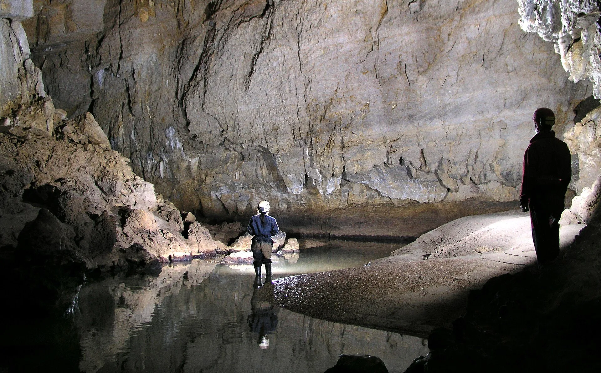
A sump is a stretch of cave where the roof drops to the water and the passage is flooded. To go on you have to dive it or wait for the water to fall. In the reports reviewed, Peruvian cave dives are of this kind: short, shallow and always after walking underground, sometimes for more than a kilometre12.
The sources reviewed do not mention tourist or recreational cave diving in Peru. Every dive cited here was exploration, done by French and Peruvian cavers with support teams who carry the cylinders to the water312.
ORKA does not offer cave, cavern or sump diving. Diving a sump is expedition speleology: it takes full cave-diving training, caving experience and a caving team behind you. If you do not have that training, this article is for reading, not for planning a trip.
A little history
From 1969 to 2003 Peruvian caving was dominated by European groups, mainly in Cajamarca and Junín. Between 2003 and 2023 the Groupe Spéléologique Bagnols Marcoule (GSBM) and the Peruvian group ECA ran 18 expeditions in the north, and the surveyed length rose from 42 km to 141 km, mainly in Amazonas and San Martín4.
Over that period almost every sump found marked the end of exploration. The ones that were dived are few, and they can be listed by name and date.
Huagapo (Palcamayo, Tarma, Junín)
Huagapo Cave is in the district of Palcamayo, at 3610 m altitude according to cuevasdelperu.org, with 2844 m of passage and 50 m of vertical range5. The 1976 French report puts it at 3570 m, on the Shaca river, and describes it as a permanent resurgence with a seasonal flow: its mouth is the fossil entrance of the system and the river emerges through a nearby sump3.
In 1972 a Polish expedition led by Maciej Kuczynski explored Huagapo as far as the sump6. The French report says it reached about 1000 m and stopped at a temporary sump that fills in the rainy season, and dates it February 19723; cuevasdelperu.org says May5.
The same year the Imperial College expedition from Britain found the sump drained by the dry season and pushed on to about 1500 m, where another sump stopped it3. The 1994 report gives 1698 m for that expedition, in August 19721. The British worked to lower the sump: at the first attempt they lowered it by only 15 cm, and later a little more; the source does not say how7. Their report in Lima concluded that the passages of Huagapo and the Sima de Milpo end in sumps separated by some 1500 m of unknown ground, and that diving equipment would be needed to get through6.
The first dive came in August 1976. The Club Aixois d'Expéditions Spéléologiques obtained diving equipment from the Peruvian Navy through the embassy and, after two attempts, passed a first sump of 2 m and a second of 8 m ending in a squeeze3. Beyond it they saw a fish about 10 cm long at 1500 m from the entrance, explored to 1780 m and turned back because a waterproof lamp failed, not because the cave closed down3. The report lists Jean Arcache, Michel Arcache, Bernard Dervillez, Jean-Baptiste Guyomarc'h and Michel Orville, but does not say who dived3.
Then came the Peruvians. According to the 1994 report, a team led by Carlos Morales Bermúdez dived the sump in 1988 and in 1989 reached the Sala de la Tranquilidad1. Other sources say the CESPE of Lima passed the terminal sumps in 199052. The dates cannot be reconciled from what is published.
On 29 July 1994 the sump was dived by Carlos Morales Bermúdez, Federico Mauren Moro, Thierry Baritaud, Pierre-Yves and Jean-François Panchout1. That expedition's report places the first sump 1250 m from the entrance: a flooded passage of 4 m, an air bell and a second sump of 8 m ending in a squeeze, with the deepest point at -4.5 m1. They surveyed 700 m of new passage up to a second sump they could not pass1. A third sump was dived for about fifteen metres without reaching its end, and the whole trip beyond the sump lasted 9 hours1.
The water was 10.8 °C according to the 1994 report1, and 11.5 °C in an ECA sample taken in 20185. The cave's length also varies by source: 2745 m1, 2787 m8 and 2844 m52. Huagapo was the longest cave in Peru until 20049; today cuevasdelperu.org ranks it sixth5. A 2008 tourism record says no further exploration has been done since 19948.
Alto Mayo (Rioja, San Martín): Palestina, Cascayunga and Aguas Claras
Palestina Cave, also called Cueva de los Guácharos, is in Nueva Cajamarca at 900 m altitude. It has 3416 m of passage, tourists visit it and it is reached by a 5-minute path10. Its first terminal sump was never dived: in 2011 ECA found a way over it, and today an upper gallery bypasses it; 200 m further on the cave ends at another sump and an impassable, strongly draughting squeeze10.
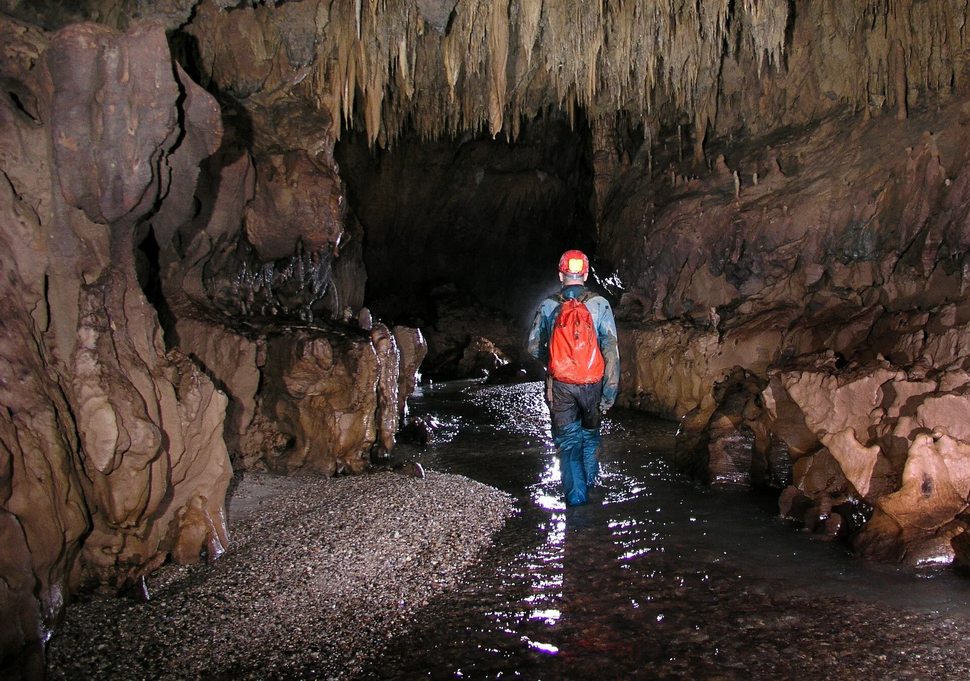

That terminal sump was attempted without success on 30 August 2016 and again on 27 August 201710. In 2017 Damien Vignoles and Naomi Mazzilli went in to dive it; the sump did not go and they came out after 3 hours11. Palestina's water was 19.8 °C in February 201810.
On 4 September 2019 Xavier Robert, supported by C. Picque and B. Lips, dived about 30 m of the sump in the Tres Perlas inlet, and the passage was left open2. The first flooded stretch is 5 m long and drops to -1 m; the second is no deeper than 2 m2. Visibility was over 10 m, but the floor carries more than 20 cm of very soft clay, and the slightest movement cuts it to a few centimetres; there are also very few points to belay the guideline2.
Cascayunga Cave, at 880 m altitude, is an active resurgence with 2805 m of passage that tourists visit after paying a modest fee12. Its terminal sump was first dived in 2018, and the sources disagree on the figures. The cave sheet in the 2019 report says that on 10 August 2018 Xavier Robert dived it for 110 m to -12 m without reaching its end2. The day's account in the same report speaks of «une centaine de mètres» with a stop at 10 m depth2. The short 2018 expedition summary gives 100 m at -15 m, without surfacing13, and cuevasdelperu.org dates the dive 9 September 201812.
On 30 August 2019 Robert went back, surfaced after 200 m at -15 m according to the cave sheet, and stopped 30 m further on at a choke of large boulders2. The diary for the same day gives 210 m for the sump2. Getting there took a 400 m approach walk and 50 minutes inside the cave, with the cylinders carried by the support team2. The sump was surveyed using the newly laid guideline, tagged every 10 m, a diving compass and the dive computer for depth2. The water was 21.1 °C in February 201812.
The resurgence of the Río Aguas Claras, in Pardo Miguel at 970 m, was dived by C. Picque and X. Robert on 8 September 2018 for 12 m; the record gives a vertical range of -10 m and a flow of 3 to 7 m³/s14. The 2018 summary confirms the dive to -10 m13. When it was gauged in July 2013 the water came out at 17.7 °C14.
The 2019 report sums up that these dives in Cascayunga and in the Tres Perlas inlet closed two exploration leads that ended in sumps, inside caves that are explored on foot2.
The sumps nobody has dived
Most Peruvian sumps appear in the reports as the end of the cave, undived. Sima Pumacocha (Laraos, Yauyos, Lima; entrance at 4375 m) ends at a sump at -638 m, reached in 2002 and again in 200415; it is the deepest shaft in Peru4. In 2004 the team climbed a muddy passage hoping to bypass that sump, but it dropped straight back into the same pool16. The sources reviewed record no dive there.
In the Cueva de San Andrés, or de los Guácharos, at 2520 m on the western edge of Cutervo National Park, the river disappears into a sump at -145 m17. In the Parjugsha system (Soloco, Chachapoyas) the main river is blocked by sumps both upstream and downstream18. In 1994 the Huari Uchco resurgence (Llata, Huánuco) stopped at a sump after about a hundred metres, and the report says the only way on would be to dive it1. None of these records mentions a dive.
In 2014 the Nueva Cajamarca expedition stopped at sumps in the Tragadero de Huaman at -174 m, in the Tragadero del Río Yuracyacu and in the La Cantarilla resurgence near Tingo María19. The temporary resurgence AC6 at Aguas Claras ended at a sump 45 m from the entrance; eleven days later the sump had drained and Jean-Yves Bigot explored 200 m of new passage on foot to a deep lake19. The small cave at Tioyacu, a resurgence fitted out for tourism, ends at a sump that the record does not list as dived20. In the Cueva de los Guácharos de Soritor the water from the upstream sump measured 21 °C; the report does not say it was dived11.
The 2019 report adds more cases: one cave ending at a sump described as «not divable» at -211 m2, and another where the cave diver, carrying only two 4 L cylinders, decided not to dive2. Near the Jadibamba river in Cajamarca a Canadian caver wrote that the caves routinely ended in sumps and that he wished he had brought his dive kit21.
Sometimes the sump is bypassed from above. In 2024 the sump of the Tragadero de la Soledad (Granada, Amazonas), an active sink that had ended at a downstream sump in 20234, was bypassed by a climb, and the cave reached 4.2 km and -325 m, the longest in Peru22.
Some large caves have no dived sumps at all. The Uchkupisjo system, which carries the Río Chancay underground (Santa Cruz, Cajamarca), has 2350 m of passage and its record does not mention diving23. In the Cueva de Samuel (Rioja, 1720 m) one passage forces a full immersion in cold water, but the record lists no dived sump24. The Naciente del Río Negro, with an average flow of 24 m³/s, is the most powerful karst spring known in South America according to GSBM4, but it is impenetrable: there is no cave to walk or dive25.
The risks the reports document
We found no documented cave-diving accident in Peru. No recorded accidents does not mean low risk; it means very few people have done it.
The reports do describe the actual hazards. Water rises: in 2024 a storm that satellite forecasts did not predict flooded the shafts of the Ojos de Lorenzo and trapped teams underground overnight22. In 1976 the French judged it impossible to enter the Río Santa's underground crossing of the Bella Durmiente massif at Tingo María through the resurgence, because the water was murky, and dangerous through the sink, because of sudden rises in water level3.
Visibility vanishes: in the Tres Perlas a single movement lets the clay cut it to a few centimetres, and there is almost nowhere to belay the guideline2. Equipment fails: in 1976 a broken waterproof lamp ended the exploration of Huagapo3. The water is cold at altitude, 10.8 °C in Huagapo1, and altitude weighs on its own: in 2004 the Pumacocha team started work at 4378 m and used coca tea and Diamox against altitude sickness16.
Some risks have nothing to do with water. The Cueva de las Lechuzas carries a warning of a high risk of histoplasmosis26. And every sump dive first demands an underground walk carrying cylinders: in Cascayunga, a 400 m approach and 50 minutes inside the cave2; in Huagapo, 1250 m to the first sump1.
We found no source on altitude decompression tables applied to Huagapo, at around 3570–3610 m53. Diving at altitude changes the decompression calculation, and that belongs in technical training, not in an article.
Training: what we know and what we do not
We found no centre or instructor in Peru offering cavern or cave diving courses. Nor did we find sources on the certifications of those who dived the Peruvian sumps, or on the equipment or gases they used, beyond scattered details such as the two 4 L cylinders of 20192.
What the reports do show is how the work is done: one cave diver goes in and a support team carries the cylinders through the cave2; the guideline is laid and marked to survey under water2; and the diver decides not to dive when the conditions or the equipment do not allow it2.
That is why we insist: recreational diving, including the diving we do at ORKA, does not prepare you for this. A diver with an open-water certification is not trained to enter a sump, not even a short and shallow one.
Protection and access
We found no SERNANP or Ministry of Culture regulation on cave diving. What exists are recommendations and local access rules.
In 1972 a report published in Lima warned of damage in Huagapo by tourists and souvenir hunters breaking stalactites, and asked that only experts go as far as the sump; the first 150 m were open to anyone with a torch6. We found no later formal restriction.
Tingo María National Park, whose main attraction is the Cueva de las Lechuzas, was created on 14 May 1965 by Law No. 1557427. The Cueva de San Andrés lies on the edge of Cutervo National Park, and its discovery in 1947 was the start of the park's creation17.
In the Alto Mayo, tourism at Palestina is run by the municipality and local associations: in 2019 a municipal employee asked the expedition to pay the entrance fee before its dive2. Cascayunga also charges a fee12. We did not find the access rules of the Alto Mayo Protection Forest for these caves.
And sea caves?
On the coast we found no sea cave documented as a dive site. One guide describes rocky overhangs and small caves at Pucusana (Lima), with water at 14 to 18 °C28; from its description, these are hollows in the reef, not cave systems.
Nor did we find documented cenotes in Peru: nothing like the flooded caves of Mexico, at least in what has been published.
What is still unknown
This article rests on expedition reports, and it has gaps. We could not read the original 1972 Imperial College report or the Polish report, and their data come from second-hand sources316. We found no primary account of the CESPE dive in Huagapo, and its year (1988–1989 or 1990) remains unreconciled512.
The Cascayunga figures and the length of Huagapo change from source to source, and we give them all here without picking one. We do not know who dived in 1976, nor what equipment and gases were used on any of these dives. If you have a report that completes or corrects any of this, write to us: we will cite it with its source.
Sources (28)
- Groupe Spéléo Méandres, Rouen (1994). Expédition Pérou 94. GSBM. gsbm.fr
- Robert, X., Bigot, J.-Y., Guyot, J.L., Lips, B. et al. (2020). Nor Perú 2019, expédition spéléologique franco-péruvienne. INGEMMET (LIB-221). app.ingemmet.gob.pe
- Club Aixois d'Expéditions Spéléologiques (1976). Spel-Inca, première expédition spéléologique française au Pérou. Fédération Française de Spéléologie. rapports-expeditions.ffspeleo.fr
- GSBM (2024). Expéditions spéléologiques au Pérou (presentación, septiembre de 2024). cuevasdelperu.org
- cuevasdelperu.org (ECA) (n.d.). Cueva de Huagapo (ficha). Cuevas del Perú. cuevasdelperu.org
- Revista Peruana de Andinismo y Glaciología n.º 10 (1972). Informe de la exploración científica de la cueva de Huagapo en Tarma hecha por la expedición británica del Imperial College de Londres. Lima. cuevasdelperu.org
- Bowser, Coward, Coward, Tunbridge, Wadge y Walkington (1972). Peruvian Andes, 1972. Mount Everest Foundation. mef.org.uk
- Flores (2008). Ficha de recursos turísticos: Cueva de Huagapo. cuevasdelperu.org
- Guyot, J.L. (2014). Conferencia en Lima, septiembre de 2014. GSBM. gsbm.fr
- cuevasdelperu.org (n.d.). Cueva Palestina (de los Guácharos). Cuevas del Perú. cuevasdelperu.org
- Bigot, J.-Y., Lips, B. et al. (2018). Expédition Cerro Blanco 2017. cuevasdelperu.org
- cuevasdelperu.org (n.d.). Cueva de Cascayunga. Cuevas del Perú. cuevasdelperu.org
- GSBM (2018). Nord Pérou 2018, compte rendu CREI. gsbm.fr
- cuevasdelperu.org (n.d.). Resurgencia del Río Aguas Claras. Cuevas del Perú. cuevasdelperu.org
- cuevasdelperu.org (n.d.). Sima Pumacocha. Cuevas del Perú. cuevasdelperu.org
- Brock, G. (2004). Peru Caving Expedition 2004: Yauyos District of Central Peru. Bristol Exploration Club / Cave Diving Group. cuevasdelperu.org
- cuevasdelperu.org (n.d.). Cueva San Andrés (de los Guácharos). Cuevas del Perú. cuevasdelperu.org
- cuevasdelperu.org (n.d.). Tragadero Parjugsha Grande. Cuevas del Perú. cuevasdelperu.org
- Klein, J.D., Guyot, J.L. y Bigot, J.-Y. (2014). Rapport de l'expédition Nueva Cajamarca 2014 (Pérou). ECA / GSBM. cuevasdelperu.org
- cuevasdelperu.org (n.d.). Resurgencia del Río Tioyacu. Cuevas del Perú. cuevasdelperu.org
- Vieira, N. (2013). The Canadian Caver n.º 78. cuevasdelperu.org
- GSBM / ECA (2025). Nord Perú 2024, rapport d'expédition. GSBM. gsbm.fr
- cuevasdelperu.org (n.d.). Cuevas Uchkupisjo. Cuevas del Perú. cuevasdelperu.org
- cuevasdelperu.org (n.d.). Cueva de Samuel. Cuevas del Perú. cuevasdelperu.org
- cuevasdelperu.org (n.d.). Resurgencia del Río Negro. Cuevas del Perú. cuevasdelperu.org
- cuevasdelperu.org (n.d.). Cueva de las Lechuzas. Cuevas del Perú. cuevasdelperu.org
- Andina (2025). ¿Por qué el Parque Nacional Tingo María es emblema de biodiversidad y turismo en Huánuco? Agencia Peruana de Noticias Andina. andina.pe
- Dive Planner Pro (n.d.). Pucusana. diveplannerpro.com